Making Waves: Integrated Watershed Management
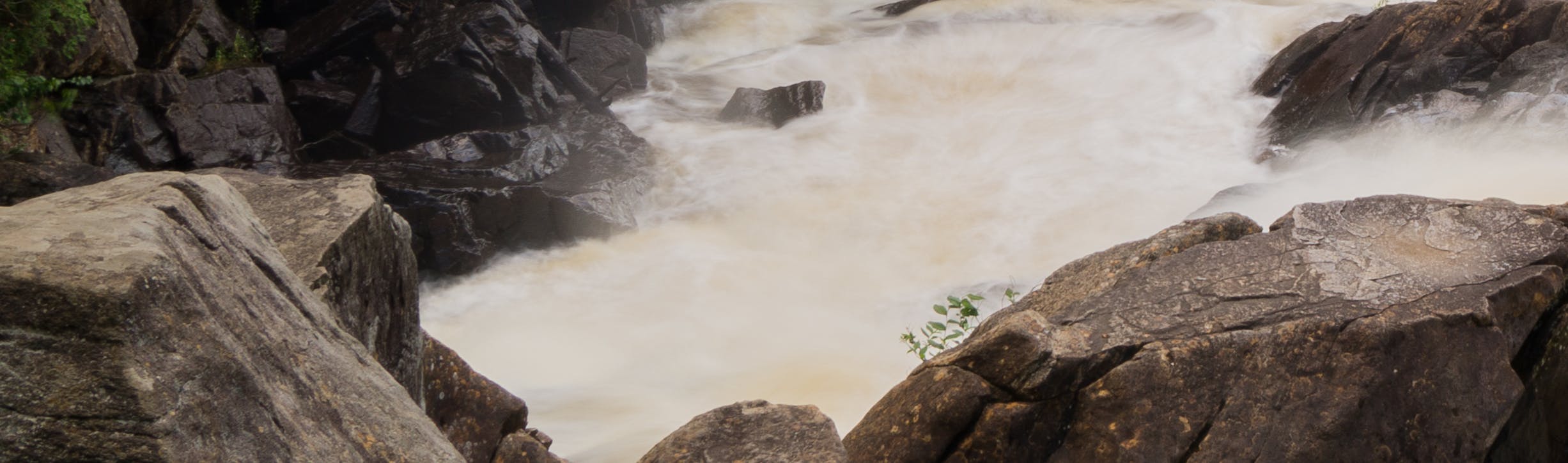
The Muskoka River Watershed is facing pressures due to increased development, severe weather events resulting from the changing climate, increased contaminants (e.g., nutrients and road salt), management of invasive species, loss of species at risk habitat, and shoreline erosion. Local residents are also concerned about water quality and quantity management and the impacts of flooding.
The Muskoka Watershed Advisory Group (MWAG) was appointed to advise the Minister of the Environment, Conservation and Parks (MECP) regarding priority geographic areas and issues in the Watershed. MWAG provided recommendations for projects across three key themes:
- Integrated Watershed Management
- Flood Mitigation
- Watershed Enhancement
In 2020, the MWAG provided a report to the Minister, highlighting important issues facing the Muskoka River Watershed, including severity and risk of flooding, erosion and siltation, threats to water quality, threats to biodiversity and natural habitat, and the need for integrated watershed management.
After careful review and consideration of the Muskoka Watershed Advisory Group's recommendations and advice, in April 2021, the Province announced an initial investment of over $4 million to fund several projects aimed at examining the existing conditions in the Watershed and exploring ways to reduce the impacts of flooding and to address the health of the Muskoka River Watershed. The District of Muskoka is leading the majority of these projects, in partnership with the Muskoka Watershed Council.
The outcomes of these projects will set the stage to design a comprehensive approach to watershed management under which land-use decisions, environmental projects, infrastructure projects, and broader public policy options can be assessed. The initiative will support and advance the implementation of an Integrated Watershed Management approach for the Muskoka River Watershed by gathering information to:
- Improve knowledge of the challenges facing the Muskoka River Watershed;
- Better understand the causes of fluctuating water levels in the Muskoka River Watershed;
- Improve understanding of erosion and siltation in the Muskoka River Watershed;
- Improve knowledge of existing and emerging threats to water quality; and
- Improve knowledge of emerging threats to biodiversity and natural habitat.
The District's 12 projects are divided into three phases. Please follow the following links to view the pages for these three phases:
The Muskoka Watershed Council is presently establishing a Community Round Table. For information on the Community Round Table or to participate, please contact crt@muskokawatershed.org
Stay Informed:
To receive Integrated Watershed Management updates and to stay informed of all environmental initiatives being undertaken by the District, please subscribe to our courtesy notice list by entering your email address in the "Stay Informed" tool (located at the top right-hand corner of this page on your desktop, or scroll down on your mobile device) and click the subscribe button.
-
Muskoka's E-RODE Survey - Now Open!
Share Muskoka's E-RODE Survey - Now Open! on Facebook Share Muskoka's E-RODE Survey - Now Open! on X (formerly Twitter) Share Muskoka's E-RODE Survey - Now Open! on Linkedin Email Muskoka's E-RODE Survey - Now Open! link
The District of Muskoka has implemented a new program that will allow citizens to collect and submit erosion information for lakes and waterways throughout the Muskoka River watershed. This project is part of the Integrated Watershed Management initiative. The program's ultimate goal is to create an inventory of eroding sites to identify areas where future work may be required to improve river and lake water quality and aquatic habitat.
This new program has been appropriately called E-Rode, which includes a new app that can be accessed on your phone anywhere you have cell reception or from your home computer. You, as a Citizen Scientist, are being given the opportunity to flag locations where you see erosion occurring on lakes or rivers. This program is part of a larger initiative being undertaken by the District of Muskoka.
Click Here To Complete the Survey
-
 Muskoka Watershed Advisory Group report on protecting the Muskoka River Watershed
-
The Case of Integrated Watershed Management in Muskoka
-
 District of Muskoka Council Reports
-
March 2021: Watershed Initiatives
-
May 2021: Budget Amendment - Integrated Watershed Management
-
August 2021: Integrated Watershed Management Initiatives Update
-
November 2021: Integrated Watershed Management Initiatives Financial
-
December 2021: Muskoka Watershed Advisory Group
-
February 2022: Provincial Subwatershed Policy Guide
-
February 2022: Integrated Watershed Management Initiatives Update
-


-
A Hydrological Model for the Muskoka River Watershed (3.27 MB) (pdf)
-
More Floodplain Mapping for Muskoka (709 KB) (pdf)
-
Enhancing Public Access in the Muskoka River Watershed for Sustainability (3.34 MB) (pdf)
-
E-Rode: The Link Between Shoreline Erosion, Public Education, and Land-use Policy (9.78 MB) (pdf)
-
The Bigger Picture of Water Quality in Muskoka (4.34 MB) (pdf)
-
Can the MRWMP help to reduce the effects of flooding (734 KB) (pdf)
-
Linking Natural Capital and Land Use in the Muskoka River Watershed (5.6 MB) (pdf)
-
Identifying structural possibilities and options to reduce flood risk in Muskoka (5.2 MB) (pdf)
-
More information = more informed decisions: A Natural Capital Inventory in Muskoka (7.78 MB) (pdf)